
Hiking in the Upper Missouri River Breaks National Monument via River


Hiking and off-trail exploration opportunities abound within the 149 mile stretch of the Upper Missouri River Breaks National Monument. There are certainly areas and trails that are heavily visited - mainly because of their accessibility and because, well, they are amazing. Then, there are areas that are largely unexplored with no established, worn trails but rather vast swaths of open range or steep coulees winding away from the river’s edge and up towards the prairie lands above. This resource will focus primarily on the second and third main sections of the monument, the White Cliffs, river mile 42-88 and the Badlands, river mile 88-149. This resource offers a short description, location and level of difficulty of each hiking opportunity as well as ideas for other areas to explore. One word of advice: the more days you spend in the monument, the more time you have to explore, immerse yourself and fully absorb the immeasurable healing effects of the life away from life.
A note about private and public property: The monument is managed by the U.S. Bureau of Land Management - a federal agency. In creating this monument, the BLM purchased a great deal of private land throughout the river corridor. You are allowed and encouraged to camp, explore and use all BLM public land (as well as the various state-owned parcels). However, there remains many private land parcels as they were grandfathered in during the monument creation. You are ONLY allowed (by state steam-access law) to access this private land UP TO the high water mark. Otherwise, camping and hiking is not permitted unless the land owner allows hiking and camping easements (usually secured through an agreement with the BLM). All public and private ownership is labeled and designated on the river maps published by the BLM. We encourage you to be respectful of private land ownership.
Maps and guidebooks: We highly recommend you consider purchasing the mile-by-mile river maps published by the Bureau of Land Management. They are waterproof and a vital resource for navigating the river. We also recommend you take along the only official guidebook and history digest written by Glenn Monahan. Click here for more information and purchase options.
Difficulty Ranking
As you paddle down this majestic river, you will want to get out, hike, explore and stretch your legs. We recommend you keep a pair of hiking shoes accessible (perhaps in your day bag) for this reason. However, there are certainly areas to visit that require very little venturing off the river bank, and can be done in your river shoes or sandals. Thus, we have labeled each hike based on the following scale:
River sandals - just a short jaunt to stretch the legs and check out a relic of significance
Moderate - light hiking shoes or tennis shoes recommended (in the very least to get your feet out of your wet river shoes for a bit)
Slightly technical - you might encounter a mini-rock scramble or steep terrain
Advanced - reasonable fitness level recommended
White Cliffs of the Upper Missouri River, River mile (RM) 42-88

… it seems like those scenes of visionary enchantment would never have an end.
-Meriwether Lewis
Tepee Rings (RM 46.7) behind Little Sandy Developed Boat Camp - River sandals - Follow the road behind the vault toilet back, then keep left along the fence on the single track trail. Follow it up the hill to the top. On top, you will see a large ring. There are two more located further upriver.
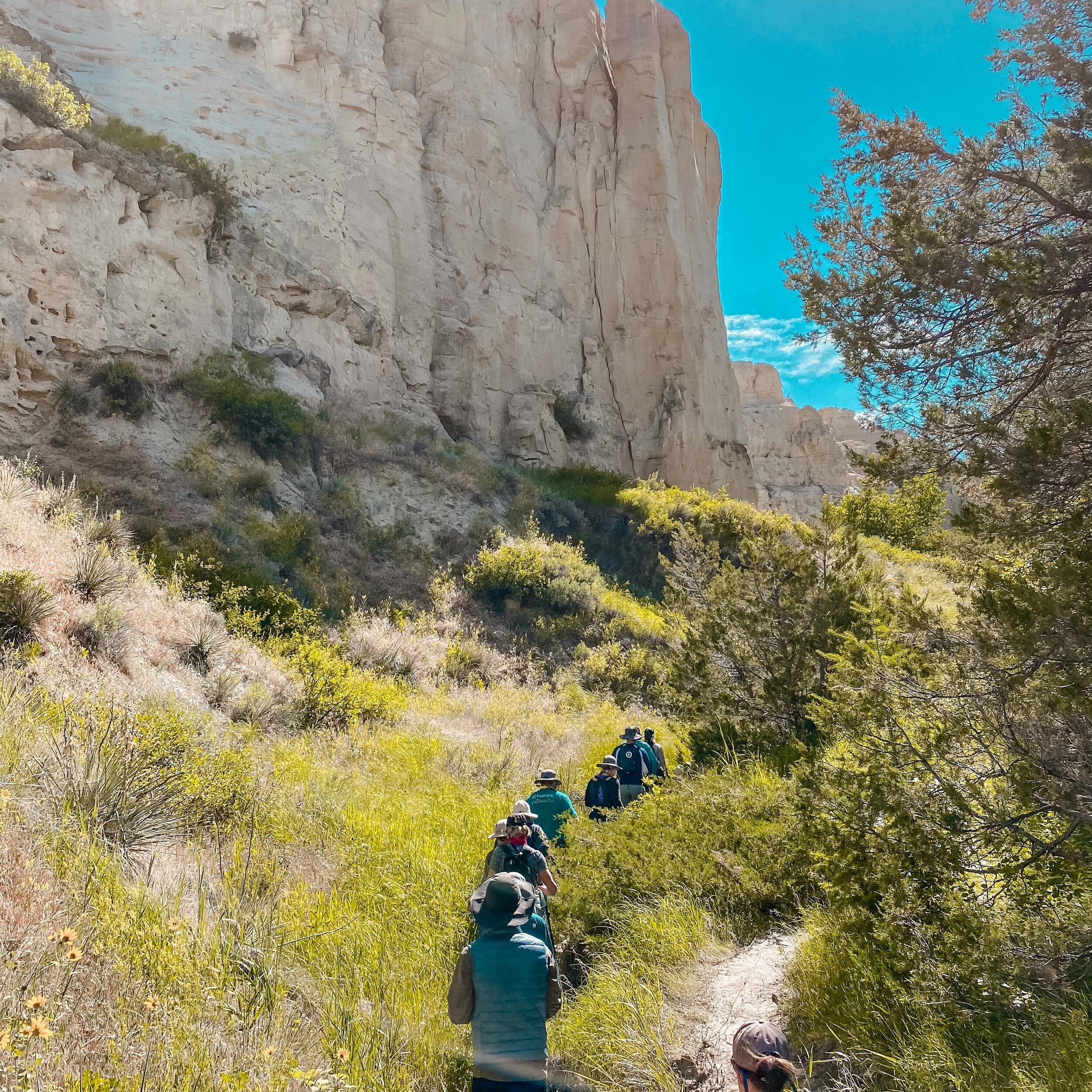
Neat Coulee (RM 56) behind Eagle Creek Developed Boat Camp - Moderate to Slightly Technical | about 3 miles, 1.5 hours, relatively zero elevation gain but a few rock scrambles - Follow the well worn trail behind the vault toilets heading down river. It winds back and into Neat Coulee drainage. You will eventually take a right into a tight slot canyon. Explore here and turn around whenever you feel the need. OR, continue through a few rock scrambles, winding through the canyon. The trail eventually continues back, but you want to take a left, which leads you up a short climb on the white sandstone. Once on top, follow the curvature of hills up and back toward the mouth of the coulee. Once you reach an obvious end point, head down the opposite side of the coulee. Take your time and exercise caution and enjoy!
Petroglyphs & Corps of Discovery Campsite (RM 56) behind Eagle Creek Developed Boat Camp - River Sandals, 45 minutes of leisurely walking - Follow the trail the opposite way into the Eagle Creek drainage. Take a right along the canyon walls to eventually cross Eagle Creek and walk to a massive wall to spot the worn petroglyphs. OR, take a left, cross Eagle Creek either via dead tree or road and follow trail to the Lewis and Clark campsite marker.
Hole in the Wall (RM 63.8) - .8 miles past Hole in the Wall Developed Boat Camp - Moderate to Slightly Technical, about 2 miles, 1.5 hours, moderate elevation gain and a few rock scrambles - Follow the well worn path behind the lone tree back towards the rock features. The trail will lead you to a bench, then further up into a mini-slot canyon. Either enjoy the view from here or muster the courage to navigate the quick scramble. Follow the rock trail towards the river, back, up and over. You can hang out here or climb down onto the flat area below. Those who feel comfortable can scramble up into the hole. (Please do not walk over and on top of the hole!).
Steamboat Rock (RM 68.8) - behind Dark Butte Primitive Boat Camp - Moderate to Advanced - 2 miles, 1-2 hours, 400 feet of elevation gain - depending on the time of year, there may be a trail, otherwise, blaze your own toward the White Sandstone feature that resembles a steamboat.
Dark Butte & Archangel (RM 68.8) - behind Dark Butte Primitive Boat Camp - Moderate to Advanced - 4 miles, 2-3 hours, 800 feet of elevation gain - There is most likely not a trail. From camp, head towards the towering red, Igneous formation. Wind your way up the hills until you gain the ridgeline. Note: you will eventually run into a fence indicating private land, which you will need to cross (please be quick and respectful). Explore Dark Butte and for those who are advanced hikers, blaze your own trail down, below the formation to gain access to the Archangel below. This hike is magnificent but you need time.
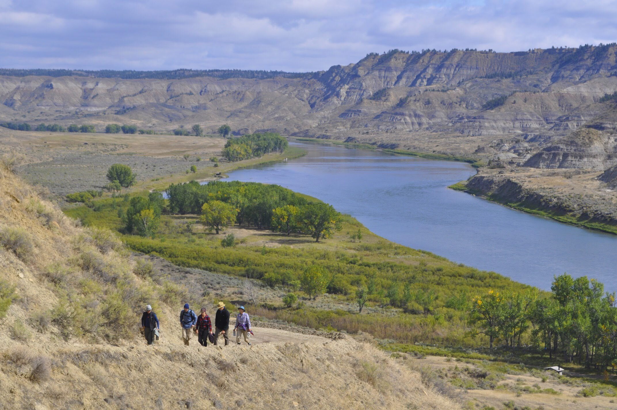
Badlands or “Breaks” of the Upper Missouri River, River Mile (RM) 88-149
This section of the Upper Missouri River is far less traveled and far more vast. We encourage you to explore on public land wherever strikes your fancy. It is magnificent, rugged and absolutely stunning.

…whilst I viewed those mountains I felt a secret pleasure in finding myself so near the head of the boundless Missouri…
- William Clark
Murray Dugout (RM 90.8) - River sandals - there is a small sign indicating the stop on the right. Walk back, up and over the hill to enter the cool dugout.
Hagadone Homestead (RM 97.0) - River sandals - a sign and well worn trail leads you up and to the homestead.
Old Army Trail (RM 101.8) - behind McClelland/Stafford Ferry - Moderate - 1-2 miles, 400 feet elevation gain, 1 hour - Locate the trail behind the ferry and follow it to a sweeping vantage point.
Behind McGarry Bar Primitive Boat Camp (RM 103.3) - Moderate - 1 mile, 1-1.5 hours, 200 feet elevation gain - Just beyond the tree, down river from the campsite is a Lewis and Clark campsite marker. You can also wander back behind and above the camp following cow and game trails to get incredible views and explore for dinosaur bones and fossils.
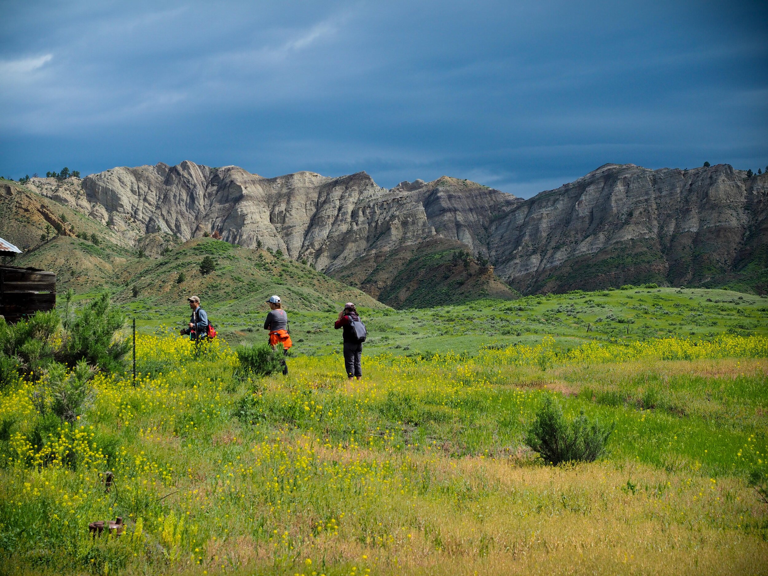
Chimney Bend & Greasewood Bottom Primitive Boat Camp (RM 107.0 - 109.6) - Moderate to Advanced - explorers’ delight - on both sides of the river, explore the coulees and prairie to your heart’s desire. Enjoy the primitive area and keep an eye out for wildlife.
Gist Homestead & Ervin Homestead (RM 122.6) - behind Gist Bottom Primitive Boat Camp - River sandals - behind the camping area, a trail leads to the extensive homestead sight. OR, hike along the river, eventually cross Bullwacker Creek and bushwack your way through the tall willows to John Ervin’s small cabin.
Snake Point Hike (RM 122.6) - behind Gist Bottom Primitive Boat Camp - Advanced, 10 miles round trip, 1000 feet elevation gain, all day adventure - you can hike this loop two different ways either by accessing from behind the Gist Homestead or down river from the camp through a dry streambed. We advise you reference the maps and guidebook for GPS coordinates and descriptions. This hike is absolutely stunning and not to be underestimated, especially during the hot days of summer.
Horseshoe Bend/Lower Woodhawk Bottom (RM 131.2) - behind Lower Wookhawk Developed Public Access Site - Moderate - 2 miles, 600 feet elevation gain - follow the road past the vault toilet and up. Once on top, follow the road for just a minute or two. Take a sharp left onto a small, grassy meadow following cow trails. Within a very short distance you will end up on a small rock ledge overlooking the astounding horseshoe bend in the river.
Hideaway Coulee (RM 138.8) - behind Hideaway Primitive Boat Camp - Moderate, exploration up to hikers’ discretion - this is a great place to wind your way on top of the stunning features or stay low and search for dinosaur bones and fossils. Enjoy the last days of your trip!
Gear, Shoes & Preparation
We recommend you always hike with water, sunscreen, maps/guidebook and a small first aid kit. Some chose to utilize hiking or trekking poles for stability on uneven terrain. Hiking shoe recommendation is based on the individual’s preference. For most hikes, light tennis shoes are adequate. However, if you feel more comfortable and stable is sturdier hiking boots, by all means, take them along.
Due to the remoteness of this river corridor, there is no cell phone reception unless you are on the top of the terrain surrounding the corridor. Thus, we do recommend you have a way to contact emergency personnel either using a satellite phone, GPS or other device with the ability to communicate.
As always, be aware the major dangers include dehydration, sun exposure, injury due to falling and rattlesnakes. Hiking poles or sticks can be used to warn the latter. Good sense and preparation usually prevent all three former dangers.
Enjoy your time in this magnificent place!